Contents
Index
Reform Digitised Road
This assumes that the Road geometry on one side is correct.
It will correct the geometry of the road and the other side (if digitised).
Parcel
Click on the parcel with the correct road Geometry
Start Point, End Point
Click on the start point and End Point of the section of the parcel to be corrected.
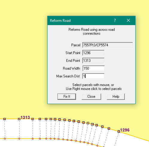
Road Width
Enter the road width, this will be used to compute the other side of the road.
Max Search Dist
Enter the max search dist to match points for connections.
Fix it
The program will walk along the road and at each IP it will compute a connection
across the road (using Road width) and search for a nearby point (within max search dist).
If a point is found and a connection is found,
The bearing and distance of the connection will be corrected and the point position corrected.
If no point is found on the other side, nothing is changed.
Note: Only digitised points are changed.
Digitised point will have all lines to them with accuracy 6 or 7
To include this Tool in Geocadastre, there has to be the following entry in the MenuColumn section of the Config file.
menuEntry menuText="Reform Digitised Road" menuItem="MENU_REFORM_ROAD"
The change to the config file can be made using a text editor.